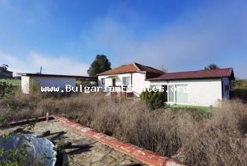
Head office location:
Bulgaria
Elhovo
Headoffice address:
8, Targovska Str., floor 2, Elhovo, Bulgaria
Phones: +359 877777960;
+359 885841230;
+359 887762939
sales@bulgarianestates.org

Town / Village: Devetak
Yard: 3900.00 sq. m.
Living area: 150.00 sq. m.
The village of Devetak is situated in South-East Bulgaria and comprises a part of Karnobat Municipality, Bourgas District. The altitude level of this region reaches 200m. The size area of the Village is approximately 40sq.km. There are 226 inhabitants, according to latest estimates.
The driving distance from Devetak to one of the main seaside centers in Bulgaria – the town of Bourgas, is 80km. There are about 48km to the city of Sliven and 15km to the municipal town of Karnobat.
The first information for Karnobat was written in 1153 and included in The Geography by Al Idrisi - an Arabian traveler and scientist. The historical sources show that since the 19th century up to present days the town has always been an administrative, economic and commercial center with a traditional yearly fair.
Karnobat municipality is included in the administrative territorial boundaries of Bourgas region(60 km west of Bourgason the way to Sofia). The Municipality uses an international transport corridor directly.
Rishki passage connects the municipality with North Bulgaria. The relief is mainly flat, cut across by the valleys of the Mochouritsa and Roussokastrenska Rivers. A part of Karnobat-Aitos Balkan is located in the northern part of the territory.
Karnobat Municipality has good environmental parameters. The region has a wide variety of game, which is favorable prerequisite for development of hunting tourism. The overall hunting area is 577 sq.km. (managed by the hunting and fishing society of the town of Karnobat).
Fishing is concentrated mainly in the 80 man-made water reservoirs, the vicinity of which is convenient for picnics, hunting and fishing. At a distance of 15 km from Karnobat is the Straldzha swamp. It is the largest inland lake in Bulgaria.
You can see the exact location of the village of Devetak on the map by visiting the following web site: BGmaps.


